| <prev< Algeria |
| >next> Saudi Arabia |
Region: Kashmir Udhampur-Srinagar-Baramulla Railway Line (USBRL) line
|
The line should connect Kashmir Valley in north western India with Jammu railway station and hence to the national network.
The 356 km railway is partly in service, but its 129km central section crossing the difficult himalayan mountain range faces ongoing severe problems and delays since construction began in 2002.
>> Show the Rail Infrastructure Observation Project Map of Kashmir USBRL railway <<.
The aim of this map is to enable research and dosumentation of USBRL. USBRL Map Data is based on aggregation of rather sparse information of different confidence level available on the internet. It seems there is no comprehensive overall project information available which is remarkable when considering the magnitude of effort and difficulties the USBRL project feces since its inception.
Clicking on any map item will open a small winod providing additional information. Please be aware that this is stiil a 0.1 release, the information not well-formatted, may not be in sync (outdated) or just consist of sketchy notes. However information should help to understand the history behind continuos project modifications nresulting in several abandoned tunnels.
The author is grateful for any valuable contribution helping to improve the ongioing USBRL map documentaion porject.
Links:
- Northern Railway Construction Organization
Publishes progress reports on an irregular basis.
changelog
|
2019.06.21 (v.0.2)
* Initial release. Progress report as of June 2019-
Some examples - click on the images to jump into the map.
|
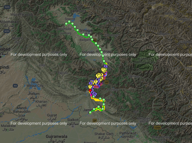
1.) Overview of the 356km long line. The plains of Kashmir in the north with its isolated single railway line. Green discs indicate operating stations along the line. The dividing Himalaya mountain range can be seen in the middle (many descriptive pins) with the 129km section still U/C since 2002, plus the southern approach line in service since the 1990ies.
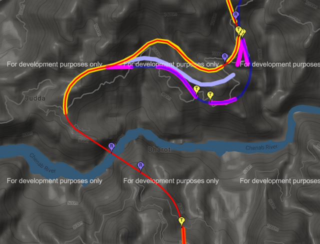
2.) Location of Chenab bridge (pin "B") and a segment of line which was realigned twice, resulting in partly abandoned tunnels T-6 to T-9 (pink). The final tunnel has recently been completed (yellow), it replaces the abandoned ones avoiding several tunnel portals in steep unstable terrain.
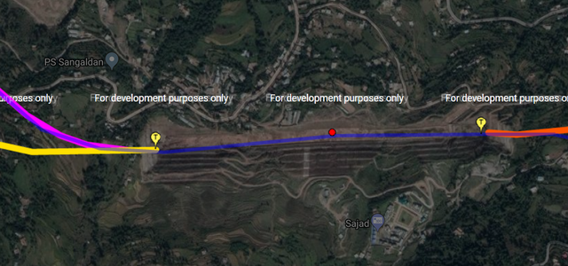
3.) Location of Sangaldan station. The single track line requires a number of stations which are not easy to build along the steep mountainsides
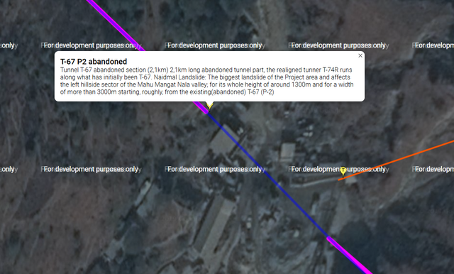
4.) Construction site between tunnel T-67 portal P2 and tunnel T-68 P1. Both tunnels have been abandoned. The line had to be moved further into the mountainside because of land slides, resulting in 7 tunnels replaced by one 8.6km long one.
| 1: Guest - 2.3 years ago | Nov 7, 2023, 9:44:07 AM |